South Sister St. Marys, Tasmania
South Sister
landslips on and around Coupe NI 114A
 |
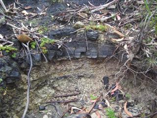 |
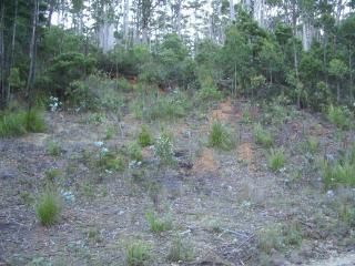
| Landslip on Dublin Town Road that occurred 15 years ago. | Close up of the coal seams near the coupe. |
Landslips have occurred on and around the South Sister for many years.
On Coupe NI114A there have been at least 4 landslides with many other slumps being visible and the possibility of many more slips. Just south of the summit but not on the coupe, it is postulated that there was a large slide thousands of years ago - (see Rallings report).
There have been slides just south of the coupe - two near Jubilee Mine, one of which in 1950 washed away part of the haulage lines. A walk on the southern side of the coupe reveals many areas which appear to be landslides although according to experts (Rallings and Stapledon) more assessment needs to be made of these (and other) slopes.
In addition, there have also been landslides on Mt Nicholas (also in the 1950s and allegedly 1 km long by 200-300 metres deep), Huntsmans' Cap (1995) to the north of Mt Nicholas, Cheeseberry Hill (1929 and 1977) which is southeast of South Sister, German Town (2 in the 1950s), Lower German Town (a couple of slides within this century).
The reason for the landslides is the increase in groundwater. There is a relationship to the coal measures on mudstone yet more work needs to be undertaken to determine the increased risks. With increases in groundwater, the likelihood of slides increases. With changes to the vegetation, groundwater is expected to increase for a few years until the uniformly growing trees start to soak up much of the groundwater. It is during the years of increased groundwater that the risk of landslides increases. David Stapledon, a renowned Engineering Geologist with 50 years of experience in landslides states that 75% of landslides studied worldwide, were in reactivated slides i.e. the risk of a slide is related to the past history. If a slide has occurred in the past, there is an increased risk of another slide. In areas adjacent to the old landslides, the surrounding area is also at increased risk. Reactivation of previous landslides is often due to disturbance of vegetation i.e. tree felling and road building - (see Report 1 and Report 2).
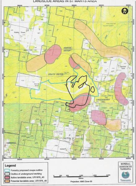
A map of the landslides in the area (using information from 1976 and not yet updated formally) shows active and potential landslides (This map uses data from a Sloane report of 1976 - see map for more details)