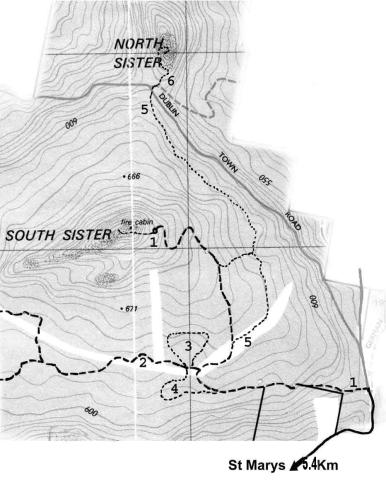
South Sister St. Marys, Tasmania
South Sister Walks - 5
brookeriana track
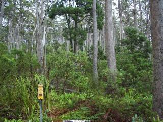
This track skirts above the Brookeriana reserve through dry sclerophyll forest. It follows the Telstra line which goes through the coupe (southeast to northwesterly direction - [see map]) culminating at the North Sister track/Dublin Town Road. The best way to access the track is to walk along the hydro power line west of the South Sister Road or through the picnic area which is just north of this power line. It is not difficult to see an area which is flatter and in parts clearer than the surrounding area. There are Telstra markers which are also visible.
Eucalyptus brookeriana is a rare eucalypt which is protected under the Regional Forest Agreement of 1997. It is a lovely tree with brownish/red trunks when younger and a more green/brown trunk when it is older.
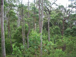
The walk goes through cutting grass initially but then opens up and magnificent views can be seen of the east coast. This track goes through two old landslip areas which can be seen both to the west and east of the track. Look for the rocky outcrop on the western side about one third of the way along the track. This demarcates the two old slip areas. There are also many crooked trees in this area which further indicates old activity.
This walk takes about 2 hours return trip.
 |
|
| Many crooked trees can be seen in this area | If you see this telstra sign you know you are on the right track. One old landslide is above this track |